POINTS OF INTEREST
 artigiani e produttori
 panorama
 cultura
 aree di sosta
MESE TO ALPE CALONES
The climb is on asphalt as far as Cigolino and a demanding one too both for the average and maximum nature of the gradient, but also for the monotony of hairpin bends: you might engage medium/high pedal assist if you have it. The last stretch to Alpe Colones is all rough track. You gradually emerge from between trees and can appreciate some expansive panorama: the depths of Valle Spluga, Val Bregaglia and Valchiavenna as far as Lake Mezzola. There is an alternative route for the return trip but it’s not advised for the non-expert: in the Cigolino area, under the huge antennae you can take a path through the woodland but it’s pretty hair-raising and precipitous by nature, taking you round the jutting spur and towards the Valle Spluga. Later on it becomes a trail (often not indicated on maps) which leads you to the village of Sommarovina; from here it‘s down once more on a steep cart track until you rejoin the road that climbs from San Giacomo to Olmo.
ALTIMETRY
DETAILS
 |
LENGTH | km |
 |
DURATION | h |
 |
difficulty | 1/4 |
 |
AVERAGE GRADIENT | % |
 |
PERIOD | From March to November |
 |
MOBILITY MEANS | e-bike |
 |
bikeability | % |
 |
TERRAIN | asphalt, pathway |
 |
PANORAMA | 4/4 |
CALCOLA IL PERCORSO
CICLOTURISMO IN VALTELLINA
Percorsi ciclabili in Valchiavenna e a Madesimo
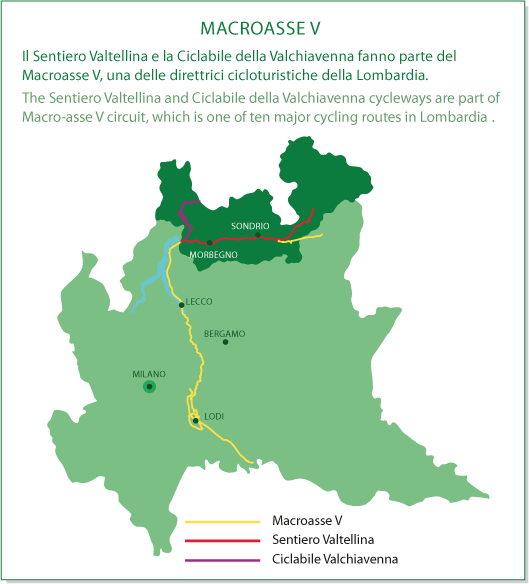
MACROASSE V