POINTS OF INTEREST
 artigiani e produttori
 panorama
 cultura
 aree di sosta
CAMPODOLCINO - BONDENO
The itinerary leaves from Campodolcino, situated at a height of 1100m, at the heart of the Alpine arc, forming part of the via Spluga, in a particularly strategic position in the past for commerce and communication between northern Europe and centres situated within the Po valley. Head off from the via Francesco, but not before casting a lingering eye over the striking “ Roman ” bridge, and the road will gently take you up to Mottala (1354) where a pond along with a small lake represent different stages of the evolution of a peat bog, which you negotiate by way of a small wooden footbridge. Moving onwards you reach Gualdera, situated in an expansive basin of woodland and meadows overlooking the valley bottom. From the locality of Palù, where after the first corner the road becomes one of restricted traffic, you pedal happily into a larch forest until you arrive at the rustic nucleus of Bondeno located on a slight slope. At the beginning of summer you’re likely to encounter cattle and sheep enjoying their Alpine sojourn grazing in the upper pastures, just as wayfarers historically have done. It’s a real treat to observe thousands of sheep at large, accompanied by their offspring gambolling around the valley’s meadows. Once at the mountain dwellings of Bondeno di Fuori you can take in some spellbinding panorama overlooking a sheer drop of around 1000 metres from where you can see the entire Valle Spluga down to Chiavenna’s valley bottom. Before going back down you might head left along a white road which is differentiated by its grass base leading you to an attractive little church and then follow a somewhat spectacular section to reach the charming nucleus of Bondeno. From here you can simply retrace your tyre-tracks. Back at Campodolcino it’s well worth a visit to the ethnographic museum MUVIS. Situated within the illustrious Palazzo of 16th century origin, renovated and enlarged in the mid-18th century, and where items and documents on the history, civilisation and traditions of the valle Spluga are on display. We also recommend the path that takes you to the well-equipped play area “Acquamerla”, where there is a “soft” water source (low in minerals) recognised for centuries.
ALTIMETRY
DETAILS
 |
LENGTH | km |
 |
DURATION | h |
 |
difficulty | 2/4 |
 |
AVERAGE GRADIENT | % |
 |
PERIOD | From May to October |
 |
MOBILITY MEANS | mountain bike |
 |
bikeability | % |
 |
TERRAIN | asphalt, pathway |
 |
PANORAMA | 4/4 |
CALCOLA IL PERCORSO
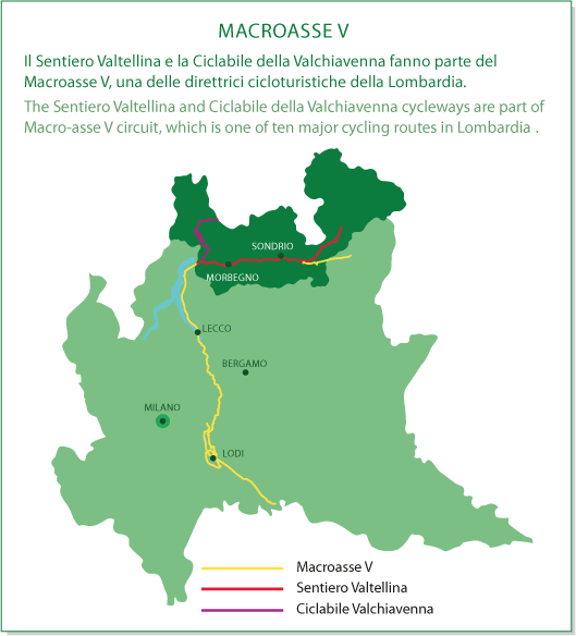
CICLOTURISMO IN VALTELLINA
Percorsi ciclabili in Valchiavenna e a Madesimo
MACROASSE V